





Source:21CMCC
2026-10-22
details
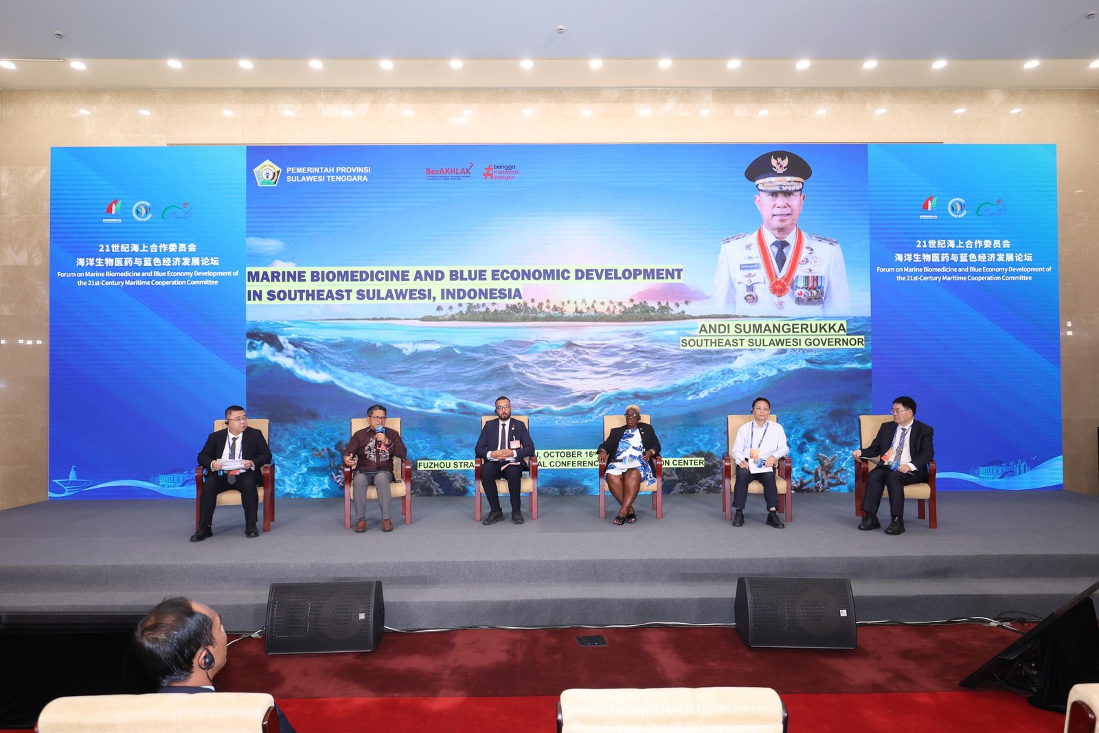
The vast blue ocean teems with infinite life, while deep-sea exploration unlocks the codes of existence. Building a maritime community with a shared future for the ocean has become a strong international consensus, and driving high-quality development of the blue economy relies on deeper and broader practical cooperation.
On the afternoon of October 16, the Forum on Marine Biomedicine and Blue Economy Development of the 21st Century Maritime Cooperation Committee was held at the Fuzhou Strait International Conference and Exhibition Center. The forum gathered over 150 participants, including representatives from members and advisors of the 21st Century Maritime Cooperation Committee, foreign embassies and consulates in China, Fuzhou’s international sister cities and friendly exchange cities, as well as renowned domestic and international experts, scholars, research institutes, and enterprise delegates. Distinguished guests attending the forum included H.E. Dr. Fazeel Najeeb, Ambassador of the Republic of Maldives to China; Ms. Wang Xiaoying, Deputy Director-General of the China Center for Contemporary World Studies; Dr. Du Guanhua, Academician of the International Eurasian Academy of Sciences, Technical Director of the “Blue Medicine Talent” Program of Ocean University of China, President of Marine Biomedical Research Institute of Qingdao; Dr. Zhang Wei, Academician of the Australian Academy of Technological Sciences and Engineering, Tan Kah Kee Chair Professor of Xiamen University, Deputy Director and Chief Scientist of Fujian Ocean Innovation Center; and Lin Xiufen, Founder and Chairwoman of Xiamen Blue Bay Science & Technology Co., Ltd.
Under the theme "Marine Biomedicine and Blue Economy Development," the forum addressed critical topics in marine resource conservation, core technology breakthroughs, the translation of scientific research into practical applications, and international collaboration. Participants exchanged insights on marine biomedical research and innovation, technological achievement translation, industrial upgrading, marine biological resource conservation, and land-sea ecological coordination. By sharing policy practices and building consensus among government, industry, and academia, the forum explored new pathways for the mutually reinforcing development of marine biomedical innovation and high-quality blue economy growth, injecting new momentum into safeguarding marine ecological barriers and fostering an inclusive, sustainable blue economy.
H.E. Dr. Fazeel Najeeb, Ambassador of the Maldives to China, stated that the ocean accounts for 99% of the Maldives' total territory, making the blue economy a vital reality for national development, with tourism and fisheries serving as the main pillars of its national economy. Marine biomedicine represents a key pillar of a diversified, high-value blue economy. The Maldives is willing to carry out scientific research cooperation and capacity building under the premise of respecting resource sovereignty, and welcomes research institutions, pharmaceutical enterprises, and maritime tech service providers from all sides to jointly promote the sustainable development of marine biomedicine and the blue economy.
Ms. Wang Xiaoying, deputy director-general of the China Center for Contemporary World Studies, stated that China's blue economy strength is steadily increasing and the scale of its marine economy continues to grow, but it also faces practical challenges such as the increasingly prominent deficit in global ocean governance. To develop the blue economy, it is necessary to further activate new quality productive forces in the marine sector, lead and promote higher-level global ocean governance, deepen and solidify cooperation in jointly building the 21st Century Maritime Silk Road, continuously deepen practical cooperation in the marine field, and promote the building of a maritime community with a shared future.
During the keynote speech session, domestic and foreign guests focused on cutting-edge topics such as the discovery of marine bioactive substances and new drug R&D, clinical translation and green manufacturing of marine medicine, and the sustainable utilization and ecological protection of marine biological resources. They shared frontier scientific achievements, analyzed industrial pain points, and jointly discussed development paths.
Focusing on the development of the "Blue Pharmacy," Dr.Du Guanhua, Academician of the International Eurasian Academy of Sciences, Technical Director of the “Blue Medicine Talent” Program of Ocean University of China, President of Marine Biomedical Research Institute of Qingdao, demonstrated a series of breakthrough achievements in China’s marine biomedical field. He pointed out that to address current bottlenecks and challenges in the industry, it is necessary to rely on modern technologies such as synthetic biology and structural biology, dig deep into historical traditional Chinese medicine resources from the ocean, and strengthen the integration of government, industry, academia, research, and application. This will help bridge the full chain from resource discovery to product implementation, transforming marine natural advantages into tangible industrial momentum.
Zhang Wei, academician of the Australian Academy of Technological Sciences and Engineering, proposed that marine biomedicine is undergoing a threefold transformation: from resource discovery to life information mining, from ocean harvesting to terrestrial biomanufacturing, and from individual drugs to the blue health industry. Given the prominent challenge of technology translation currently facing the sector, there is a need to unblock the entire chain spanning resources, standards, validation, manufacturing, and markets. The core of future competition lies in efficiently translating marine life information into health and industrial value.
Drawing on twenty years of industrial practice, Lin Xiufen, Chairwoman of Xiamen BlueBay Science & Technology Co., Ltd., shared that the marine economy is shifting from resource extraction to industrial capacity building. Deeply rooted in the marine biomedical sector, her enterprise has overcome key technical hurdles in high-purity glucosamine and established a full industrial chain covering raw materials, formulations, and end products. Adhering to green, circular development, the company looks forward to deepening industry-university-research synergy to turn marine resource advantages into global industrial competitiveness.
The panel discussion featured two thematic sessions: “Innovation-Driven Development with Ecological Priorities: New Pathways for High-Quality Development of Marine Biomedicine” and “Industry-University-Research-Application Collaboration: Creating a New Pattern of Global Cooperation in Marine Biomedicine”. Participating experts and business leaders expressed their insights and exchanged ideas, contributing valuable wisdom to improving quality and efficiency in the marine biomedical industry and deepening global marine industrial cooperation.
From the sustainable utilization of marine biological resources to the joint protection of marine ecological security, the 21st-Century Maritime Cooperation Committee is steering steadily toward the deep blue of high-quality maritime development, with science and technology as its oars and ecology as its sail. As a specialized committee jointly initiated by the Chinese People's Association for Friendship with Foreign Countries (CPAFFC) and the Fuzhou Municipal People's Government within the framework of UCLG ASPAC, the 21st-Century Maritime Cooperation Committee has connected 80 members across 29 countries on five continents since its establishment, constructing an inclusive, shared, and sustainable space for dialogue and cooperation.
This forum stands as a vivid practice of the Committee extending its platform advantages into the new frontier of marine biomedicine and the blue economy. By building consensus through international dialogue and linking the full "R&D–Application–Protection" chain through multi-stakeholder collaboration, the Committee will continue to play its role as a bridge and bond, ensuring that marine biomedical innovations better benefit all parties while injecting lasting momentum into global blue economy prosperity and the improvement of the ocean governance system.
It is reported that during the conference, attending guests will also deeply participate in a series of activities under the 2026 World Maritime Equipment Conference and conduct field visits, further expanding space for cooperation and deepening pragmatic outcomes.
Source: 21CMCC
2026-10-17
details
2026-10-12
details
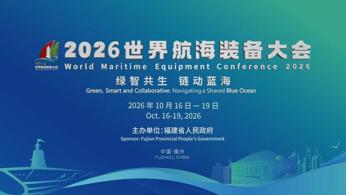
The 2026 World Maritime Equipment Conference will take place in Fuzhou, Fujian Province, from October 16 to 19. The Information Office of the Fujian Provincial People's Government held a press conference on the October 21st to introduce relevant details.
According to the briefing, themed "Green, Smart and Collaborative: Navigating a Shared Blue Ocean", this year's conference will feature an opening ceremony, four main events, and a series of supporting and concurrent activities. It is expected to attract guests and participants from more than 50 countries and regions. Guangdong Province will serve as the Guest Province of Honor, Shanghai Jiao Tong University and Harbin Engineering University as the Guest Universities of Honor, and Perpignan, France, as the Guest City of Honor.
The conference is hosted by the People's Government of Fujian Province, and co-organized by the Fuzhou Municipal People's Government, ten Fujian provincial departments (including the Fujian Provincial Department of Industry and Information Technology), the China Center for Information Industry Development (CCID), and the China-ASEAN Industry Cooperation and Development Promotion Association.
Source: XINHUA
2026-09-28
details


OFFICIAL WECHAT
Email:
secretariat_21cmcc@163.com
Telephone:
+86-591-83532970
+86-591-83533101
Fax:
+86-591-83531520
Address:
Room 728, Building 3, Eastern Municipal Government Office Compound, 193 South Riverside West Avenue, Cangshan District, Fuzhou City, Fujian Province, China
Set As Default Home Page|Add To Favorites|CONTACT US
Copyright: © 21st-Century Maritime Cooperation Committee Public security record number:35010402351060 闽ICP备2020019451号